Fichier:Carte Maghreb Vuillemin 1843.jpg

Ce fichier provient de un dépôt partagé. Il peut être utilisé par d'autres projets. Sa description sur sa page de description est affichée ci-dessous.


![[1]](http://commons.wikimedia.org/w/index.php?title=File:Carte_Maghreb_Vuillemin_1843.jpg&oldid=59584856)
Description
| Description |
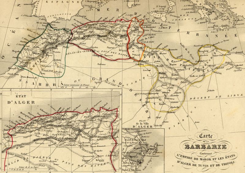
français : Carte géographique ancienne du Maghreb / Afrique du Nord (Maroc, Algérie, Tunisie, Lybie) avec noms en français dressée par le géographe Alexandre Vuillemin en 1843 extraite de son “Atlas universel de géographie ancienne et moderne à l'usage des pensionnats”. Le titre original de cette carte est “Carte de la Barbarie contenant l'empire de Marok et les états d'Alger de Tunis et de Tripoli”.
Cet atlas était initialement monochrome mais son premier propriétaire a réhaussé manuellement en couleur les frontières ou limites administratives.
English: Map of Maghreb / Northern Africa (Morocco, Algeria, Tunisia, Libya) with french names made by Alexandre Vuillemin in 1843 extracted from his “Atlas universel de géographie ancienne et moderne à l'usage des pensionnats”.
|
|---|---|
| Date |
1843 |
| Source | |
| Author |
Alexandre Vuillemin (reproduit par histoirepostale.net) |
| Permission (Reusing this file) |
See below. |
Licence
| This image is in the public domain because it is a mere mechanical scan or photocopy of a public domain original, or – from the available evidence – is so similar to such a scan or photocopy that no copyright protection can be expected to arise. The original itself is in public domain for the following reason:
This tag is designed for use where there may be a need to assert that any enhancements (eg brightness, contrast, colour-matching, sharpening) are in themselves insufficiently creative to generate a new copyright. It can be used where it is unknown whether any enhancements have been made, as well as when the enhancements are clear but insufficient. For known raw unenhanced scans you can use an appropriate Template:T tag instead. For usage, see Commons:When to use the PD-scan tag. Note: This tag applies to scans and photocopies only. For photographs of public domain originals taken from afar, Template:T may be applicable. See Commons:When to use the PD-Art tag. English | español | suomi | français | italiano | 日本語 | македонски | Plattdüütsch | português | русский | +/− |
Historique du fichier
Cliquer sur une date et heure pour voir le fichier tel qu'il était à ce moment-là.
| Date et heure | Vignette | Dimensions | Utilisateur | Commentaire | |
|---|---|---|---|---|---|
| actuel | 12 décembre 2020 à 15:24 | | 3 325 × 2 352 (3,37 Mio) |
Utilisation du fichier
La page suivante utilise ce fichier :