Difference between revisions of "Hobet mine"
From Wicri Urban Soils
imported>Jacques Ducloy |
imported>Jacques Ducloy m (4 revisions imported) |
||
| (2 intermediate revisions by the same user not shown) | |||
| Line 5: | Line 5: | ||
Satellite images (LANDSAT) show the evolution of related soils between 1994 and 2009. | Satellite images (LANDSAT) show the evolution of related soils between 1994 and 2009. | ||
| + | {{clr}} | ||
==External links== | ==External links== | ||
* Wikipedia: [[wikipedia:Mountaintop removal mining|Mountaintop removal mining]] | * Wikipedia: [[wikipedia:Mountaintop removal mining|Mountaintop removal mining]] | ||
| − | [[fr:Hobet | + | [[category:coil mining]] |
| + | [[fr:Mine de Hobet]] | ||
Latest revision as of 19:21, 28 June 2017
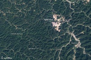
The Hobet mine is a coal mine that uses "Mountaintop removal mining" techniques.
This mine is located close to Madison, West Virginia.
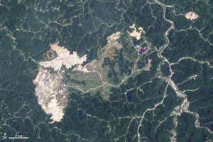
Satellite images (LANDSAT) show the evolution of related soils between 1994 and 2009.
External links
- Wikipedia: Mountaintop removal mining

