File:Maroc protectorat sans cadre.svg.png
From Wicri pool V1.31 Démo.Istex
Revision as of 17:48, 6 July 2017 by Maintenance script (talk) (Maintenance script uploaded File:Maroc protectorat sans cadre.svg.png)
Size of this preview: 627 × 599 pixels. Other resolutions: 251 × 240 pixels | 1,000 × 956 pixels.
Original file (1,000 × 956 pixels, file size: 190 KB, MIME type: image/png)

Summary
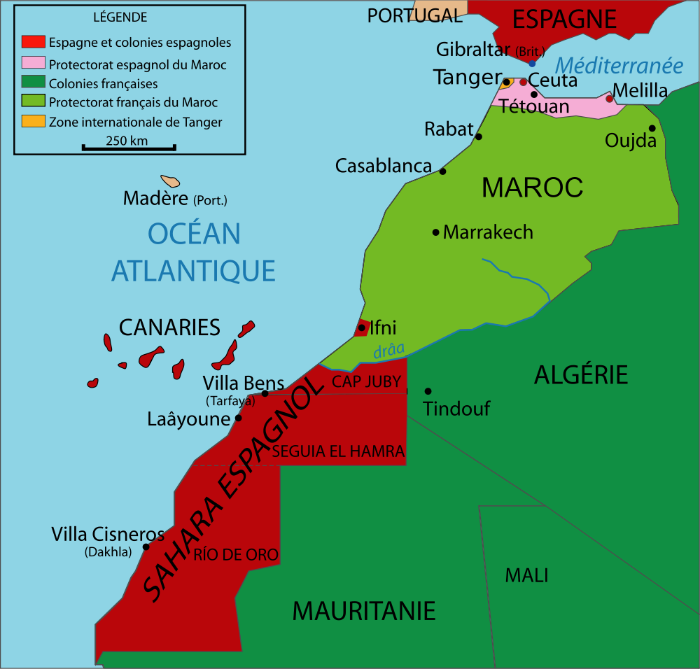
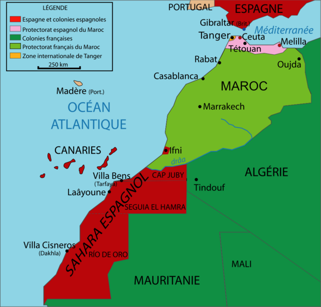
Vectorized map about the French and Spanish protectorates on Morocco in 1912. Own work inspired from Jean Sellier, Atlas des peuples d'Afrique, p. 84.
Protectorat marocain.
Protectorado maroqui.
- A French PNG version is available Image:Marrocoprotectorate.png
- An English SVG version is available Image:Morocco Protectorate.svg
Licensing:
Kimdime, the copyright holder of this work,' has published or hereby publishes it under the following licenses:
Template:License migration redundant
|

![[1]](http://commons.wikimedia.org/w/index.php?title=File:Maroc_sans_cadre.svg&oldid=55712591)
File history
Click on a date/time to view the file as it appeared at that time.
| Date/Time | Thumbnail | Dimensions | User | Comment | |
|---|---|---|---|---|---|
| current | 12:16, 12 December 2020 | | 1,000 × 956 (190 KB) | Maintenance script (talk | contribs) |
- You cannot overwrite this file.
File usage
The following 3 pages link to this file:
Metadata
Categories:
- File imported from Wikimedia Commons
- GFDL
- CC-BY-SA-3.0-migrated
- CC-BY-SA-2.5,2.0,1.0
- Self-published work
- Maps of the history of Morocco
- Maps of the history of Spain
- Maps showing the history of French colonies
- SVG maps in French
- SVG maps of Africa
- Mapas de territorios dependientes de España
- Maps of Spanish Morocco
- Bug SVG