File:Guadeloupe department location map.svg
From Wicri pool V1.31 Démo.Istex
Revision as of 14:13, 12 December 2020 by Maintenance script (talk | contribs) (Maintenance script uploaded File:Guadeloupe department location map.svg)

Size of this PNG preview of this SVG file: 684 × 600 pixels. Other resolution: 274 × 240 pixels.
Original file (SVG file, nominally 1,015 × 890 pixels, file size: 217 KB)

Summary
| Description |
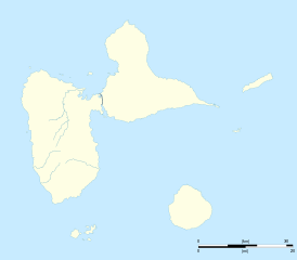
English: Blank administrative map of the region and department of Guadeloupe, France, for geo-location purpose, with arrondissements boundaries.
français : Carte administrative vierge de la région et département de Guadeloupe, France, destinée à la géolocalisation, avec limite des arrondissements. Equirectangular projection, WGS84 datum
Geographic limits of the map:
| ||
|---|---|---|---|
| Date |
{{MediaWiki:SeptemberTemplate:I18n month/form/⧼lang⧽ }} 2008 | ||
| Source |
Own work
| ||
| Author | |||
| Permission (Reusing this file) |
| ||
| Other versions |
|

Licensing:

![[1]](http://commons.wikimedia.org/w/index.php?title=File:Guadeloupe_department_location_map.svg&oldid=27196113)
File history
Click on a date/time to view the file as it appeared at that time.
| Date/Time | Thumbnail | Dimensions | User | Comment | |
|---|---|---|---|---|---|
| current | 14:13, 12 December 2020 | | 1,015 × 890 (217 KB) | Maintenance script (talk | contribs) |
- You cannot overwrite this file.
File usage
The following 2 pages link to this file: