Difference between revisions of "File:Maroc protectorat sans cadre.svg.png"
From Wicri pool V1.31 Démo.Istex
(Maintenance script uploaded File:Maroc protectorat sans cadre.svg.png) |
(Maintenance script uploaded File:Maroc protectorat sans cadre.svg.png) |
(No difference)
| |
Latest revision as of 12:16, 12 December 2020

Summary
Vectorized map about the French and Spanish protectorates on Morocco in 1912. Own work inspired from Jean Sellier, Atlas des peuples d'Afrique, p. 84.
Protectorat marocain.
Protectorado maroqui.
- A French PNG version is available Image:Marrocoprotectorate.png
- An English SVG version is available Image:Morocco Protectorate.svg
Licensing:
Kimdime, the copyright holder of this work,' has published or hereby publishes it under the following licenses:
Template:License migration redundant
|

![[1]](http://commons.wikimedia.org/w/index.php?title=File:Maroc_sans_cadre.svg&oldid=55712591)
File history
Click on a date/time to view the file as it appeared at that time.
| Date/Time | Thumbnail | Dimensions | User | Comment | |
|---|---|---|---|---|---|
| current | 12:16, 12 December 2020 | 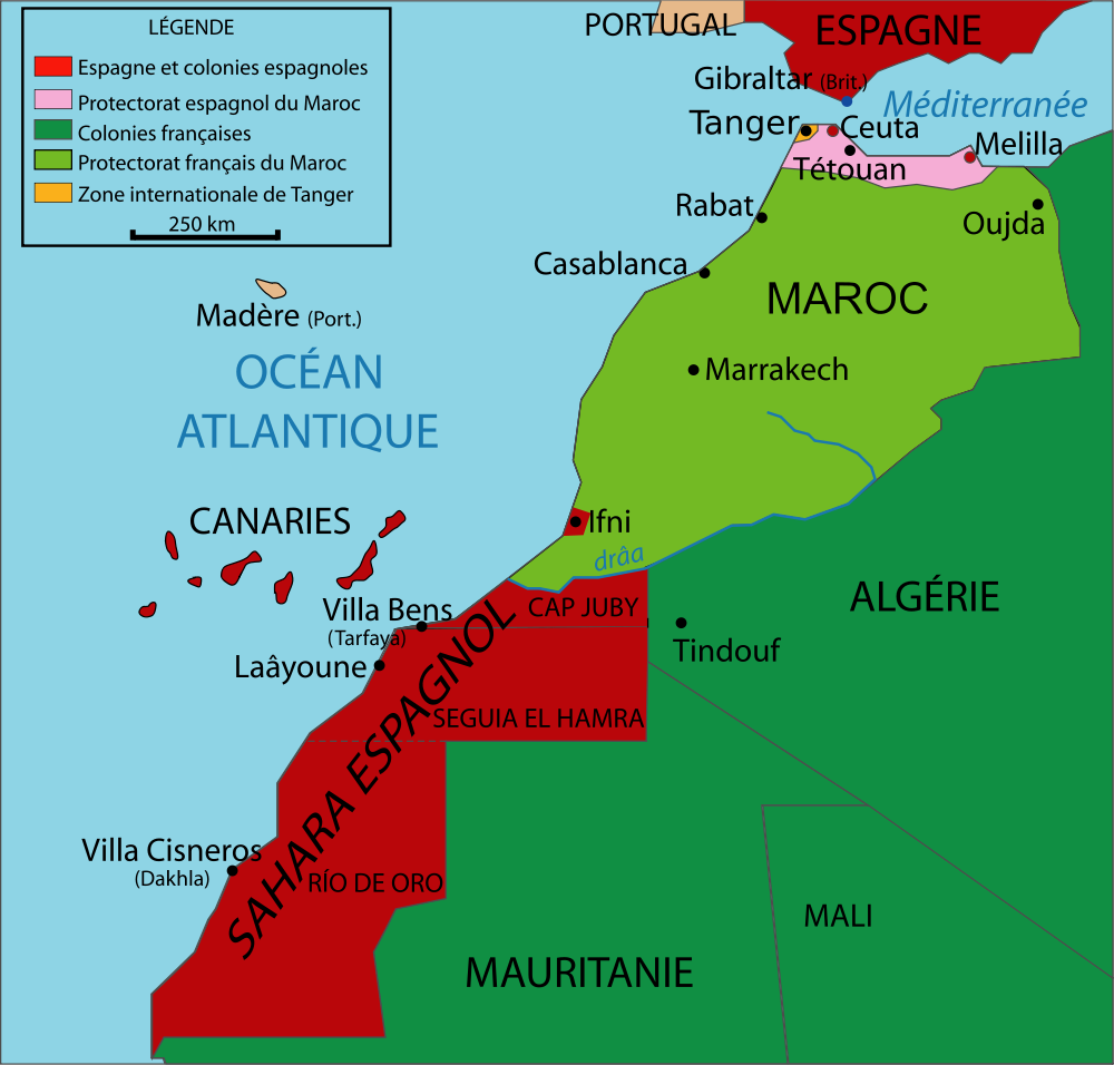 | 1,000 × 956 (190 KB) | Maintenance script (talk | contribs) |
- You cannot overwrite this file.
File usage
The following 3 pages link to this file:
Metadata
Categories:
- File imported from Wikimedia Commons
- GFDL
- CC-BY-SA-3.0-migrated
- CC-BY-SA-2.5,2.0,1.0
- Self-published work
- Maps of the history of Morocco
- Maps of the history of Spain
- Maps showing the history of French colonies
- SVG maps in French
- SVG maps of Africa
- Mapas de territorios dependientes de España
- Maps of Spanish Morocco
- Bug SVG