File:German postcode information.png
From Wicri pool V1.31 Démo.Istex
Size of this preview: 445 × 600 pixels. Other resolutions: 178 × 240 pixels | 902 × 1,216 pixels.
Original file (902 × 1,216 pixels, file size: 138 KB, MIME type: image/png)

![[1]](http://commons.wikimedia.org/w/index.php?title=File:German_postcode_information.png&oldid=57483579)
Summary
| Description |
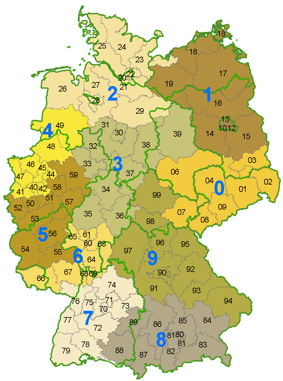
Deutsch: Karte der Postleitzahlen mit Zonen der ersten 2 Ziffern der PLZ und den Bundeslandgrenzen
|
|---|---|
| Date |
18 {{MediaWiki:JuneTemplate:I18n month/form/⧼lang⧽ }} 2003 |
| Source |
Own work |
| Author | |
| Permission (Reusing this file) |
See below. |
Licensing:
| Creative Commons CC-Zero | This file is made available under the Creative Commons CC0 1.0 Universal Public Domain Dedication. |
| ⧼Wm-license-cc-zero-explanation⧽
|
File history
Click on a date/time to view the file as it appeared at that time.
| Date/Time | Thumbnail | Dimensions | User | Comment | |
|---|---|---|---|---|---|
| current | 15:23, 12 December 2020 | | 902 × 1,216 (138 KB) | Maintenance script (talk | contribs) |
- You cannot overwrite this file.
File usage
The following page links to this file: