File:Carte administrative du Canada.png
Summary
| Description |
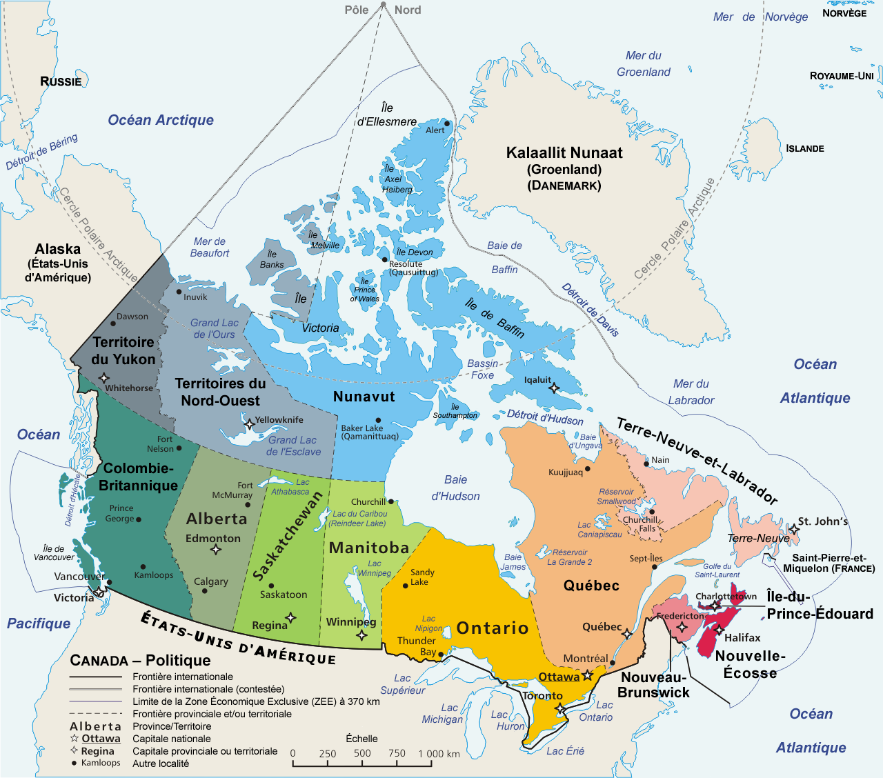
Political map of Canada in French | ||
|---|---|---|---|
| Date |
Original file : March 2006 | ||
| Source |
en:Image:Map_Canada_political-geo.png, drawn and adapted by E Pluribus Anthony from Atlas of Canada | ||
| Author |
Original file : E Pluribus Anthony | ||
| Permission (Reusing this file) |
Public domain
| ||
| Other versions | Image:Map_Canada_political-fr.png (Canada only, in French) |
- Sujet : Carte politique du Canada en français ;
- Source : en:Image:Map_Canada_political-geo.png, dessinée et adaptée de l' Atlas du Canada par E Pluribus Anthony ;
- Auteurs :
- image originale : E Pluribus Anthony ;
- cette version : fr:Sting avec indication de traduction de fr:Sébastien Savard ;
- Date :
- image originale : Mars 2006 ;
- traduction : Août 2006 ;
- Autre version : Image:Map_Canada_political-fr.png (Canada seul, en français).
Template:Atelier graphique carte
Licensing:
This image has been (or is hereby) released into the public domain by its creator, E Pluribus Anthony. This applies worldwide. In case this is not legally possible, the creator grants anyone the right to use this work for any purpose, without any conditions, unless such conditions are required by law. |
File history
Click on a date/time to view the file as it appeared at that time.
| Date/Time | Thumbnail | Dimensions | User | Comment | |
|---|---|---|---|---|---|
| current | 15:23, 12 December 2020 | | 1,280 × 1,128 (522 KB) | Maintenance script (talk | contribs) |
- You cannot overwrite this file.
File usage
The following 3 pages link to this file: