Fichier:Ireland location map.svg
De Wicri Histoire de la Lorraine

Taille de cet aperçu PNG de ce fichier SVG : 481 × 599 pixels. Autre résolution : 192 × 240 pixels.
Fichier d’origine (Fichier SVG, résolution de 1 450 × 1 807 pixels, taille : 597 Kio)
Ce fichier provient de un dépôt partagé. Il peut être utilisé par d'autres projets. Sa description sur sa page de description est affichée ci-dessous.


Description
| Description |
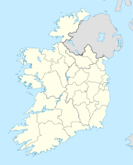
Template:De Quadratische Plattkarte, N-S-Streckung 170 %. Geographische Begrenzung der Karte:
English: Location map of Ireland
Equirectangular projection, N/S stretching 170 %. Geographic limits of the map:
|
|---|---|
| Date |
01-07-2008 |
| Source |
own work, using United States National Imagery and Mapping Agency data |
| Author | |
| Permission (Reusing this file) |
See below. |
| Other versions |
DerivativeVersions
|

Conditions d'utilisation

Historique du fichier
Cliquer sur une date et heure pour voir le fichier tel qu'il était à ce moment-là.
| Date et heure | Vignette | Dimensions | Utilisateur | Commentaire | |
|---|---|---|---|---|---|
| actuel | 12 décembre 2020 à 15:21 | | 1 450 × 1 807 (597 Kio) |
Utilisation du fichier
La page suivante utilise ce fichier :