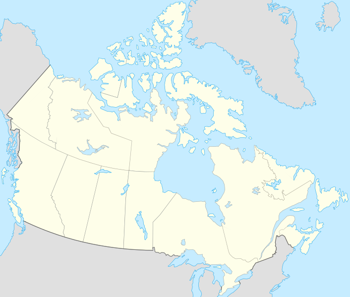
Fichier:Canada location map.svg
De Wicri Sarre
Aller à :navigation, rechercher

Taille de cet aperçu PNG de ce fichier SVG : 706 × 599 pixels. Autre résolution : 283 × 240 pixels.
Fichier d’origine (Fichier SVG, résolution de 1 084 × 920 pixels, taille : 67 Kio)
Ce fichier provient de un dépôt partagé. Il peut être utilisé par d'autres projets. Sa description sur sa page de description est affichée ci-dessous.

|
Ce fichier provient du pool d'images Wicri/Site Démo.Istex (pool V1.31) et peut être utilisé par d’autres wikis du réseau. Sa page de description, affichée ci-dessous, est construite à partir de la page correspondante dans le pool. |

|
File imported from Wikipedia Commons, see:
|
| Description | Canada location map.svg
English: cropped version of Image:Carte administrative du Canada.svg for map location.
|
|---|---|
| Date |
2008-07-17 22:08 (UTC) |
| Source | |
| Author |
|
| Permission (Reusing this file) |
See below. |
| Other versions | Template:DerivativeVersions |
|
Template:Original upload log
This image is a derivative work of the following images:
- Image:Canada_(geolocalisation).svg licensed with Cc-by-sa-2.5,2.0,1.0, GFDL
- 2007-02-07T01:48:11Z STyx 1084x920 (95884 Bytes) retouche mineure
- 2007-02-07T01:41:09Z STyx 1084x920 (95939 Bytes) {{Created with Inkscape}} {{Information |Description= *{{fr}} Version recadrée et épurée de [[:Image:Carte administrative du Canada.svg]] pour la géolocation du Canada. Le cadrage est x=80px, y=166px, height=920, width=10
Historique du fichier
Cliquer sur une date et heure pour voir le fichier tel qu'il était à ce moment-là.
| Date et heure | Vignette | Dimensions | Utilisateur | Commentaire | |
|---|---|---|---|---|---|
| actuel | 12 décembre 2020 à 14:13 |  | 1 084 × 920 (67 Kio) |
Utilisation du fichier
La page suivante utilise ce fichier :
Métadonnées
Ce fichier contient des informations supplémentaires, probablement ajoutées par l'appareil photo numérique ou le numériseur utilisé pour le créer.
Si le fichier a été modifié depuis son état original, certains détails peuvent ne pas refléter entièrement l'image modifiée.
| Largeur | 1084 |
|---|---|
| Hauteur | 920 |
