 Attention, suite à une faille de sécurité, les liens vers les serveurs d'exploration sont désactivés.
-
De Wicri Rhénanie-Palatinat
Ce fichier provient de un dépôt partagé. Il peut être utilisé par d'autres projets.
Sa description sur sa page de description est affichée ci-dessous.

|
File imported from Wikipedia Commons, see:
|
Description
| Description
|
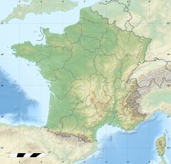
France relief location map.jpg
English: Blank physical map of France for geo-location purpose. Scale : 1:14,816,000 (accuracy : about 3,7 km) for the bathymetry
français : Carte physique vierge de la France destinée à la géolocalisation. Échelle : 1:14 816 000 (précision : environ 3,7 km) pour la bathymétrie
Equirectangular projection, WGS84 datum
- Central meridian: 002° 06' E
- True scale parallel: 46° 15' N
Geographic limits of the map :
- West : 005° 48' W
- East : 10° E
- North : 51° 30' N
- South : 41° N
|
| Date
|
{{MediaWiki:JulyTemplate:I18n month/form/⧼lang⧽ }} 2008(2008-07)
|
| Source
|
Own work
- Bathymetry : NGDC ETOPO2v2 (public domain) ;
- Topography : NASA Shuttle Radar Topography Mission (SRTM30 v.2) (public domain) ;
- Shoreline and additional data : World Data Base II (public domain).
|
| Author
|
Eric Gaba (Sting - fr:Sting)
|
Permission
(Reusing this file)
|
| Attribution and Share-Alike required
|
| Any use of this map can be made as long as you credit me (Eric Gaba – Wikimedia Commons user: Sting) as the author and distribute the copies and derivative works under the same license(s) that the one(s) stated below. A message with a reply address would also be greatly appreciated.
| |
| Other versions |
Template:DerivativeVersions
Template:Location
France relief location map.jpg
Equivalent administrative map (regions)
France location map.svg
from the german team (slight difference in the geographic limits of the map)
France location map-Departements.svg
Equivalent administrative map (départements)
France location map-Regions and departements.svg
Equivalent administrative map (regions and départements distinguished)
|
Template:Overlay
Template:Atelier graphique carte
Licence
Template:ImageNote
Template:Text fr
Template:Zh
Template:ImageNoteEnd
Historique du fichier
Cliquer sur une date et heure pour voir le fichier tel qu'il était à ce moment-là.
| Date et heure | Vignette | Dimensions | Utilisateur | Commentaire |
|---|
| actuel | 12 décembre 2020 à 15:03 |  | 2 000 × 1 922 (814 Kio) | | |
Utilisation du fichier
Les 2 pages suivantes utilisent ce fichier :
Ce fichier contient des informations supplémentaires, probablement ajoutées par l'appareil photo numérique ou le numériseur utilisé pour le créer.
Si le fichier a été modifié depuis son état original, certains détails peuvent ne pas refléter entièrement l'image modifiée.


![[1]](http://commons.wikimedia.org/w/index.php?title=File:France_relief_location_map.jpg&oldid=47997713)