File:Perca fluviatilis distribution map.png
From Wicri Water
Size of this preview: 800 × 406 pixels. Other resolutions: 320 × 162 pixels | 1,444 × 733 pixels.
Original file (1,444 × 733 pixels, file size: 199 KB, MIME type: image/png)

Summary
| Description |
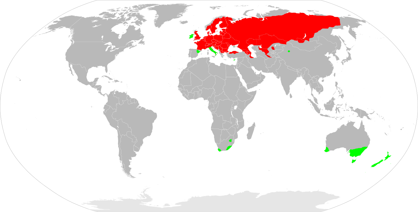
English: European Perch (Perca fluviatilis) distribution map. Red: approximate range where they live naturally. Green: introduced non-native populations.
|
|---|---|
| Date |
20 {{MediaWiki:NovemberTemplate:I18n month/form/⧼lang⧽ }} 2009 |
| Source |
Own work |
| Author | |
| Permission (Reusing this file) |
See below. |
Сreated by Inkscape.
Data sources to build this map:
- Kottelat M., Freyhof J. Handbook of European freshwater fishes. — 2007.
- Atlas of Russian Freshwater Fishes: In 2 Vol. Vol. 2 / Ed. by Yu.S. Reshetnikov. - 2003.
- Skelton P.H. A complete guide to the freshwater fishes of Southern Africa. — 2001.
- Rowe D., Moore A., Giorgetti A., Maclean C., Grace P., Wadhwa S., Cooke J. Review of the impacts of gambusia, redfin perch, tench, roach, yellowfin goby and streaked goby in Australia. — 2008.
- Rowe D.K., Graynoth E. Fish in New Zealand Lakes. — 2002.
Licensing:

![[1]](http://commons.wikimedia.org/w/index.php?title=File:Perca_fluviatilis_distribution_map.png&oldid=37836631)
File history
Click on a date/time to view the file as it appeared at that time.
| Date/Time | Thumbnail | Dimensions | User | Comment | |
|---|---|---|---|---|---|
| current | 15:22, 12 December 2020 | | 1,444 × 733 (199 KB) |
File usage
The following page links to this file: